
Advanced Sector Transmission Technology
The transmit beam sector is divided into multiple (up to 16) independently controlled sub-sectors, effectively suppressing multiple reflection interference and obtaining "cleaner" data.
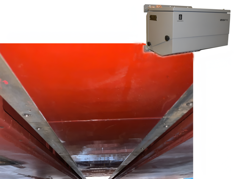
The Kongsberg EM medium to deep water series is the industry standard for high-resolution seabed mapping on continental slopes and at full ocean depths. This series is based on a modular design, utilizing advanced sector transmission and real-time beam focusing technology to provide mapping data that exceeds IHO Special Order standards, with rich detail and a very high signal-to-noise ratio, across depth ranges from a few hundred meters to over ten thousand meters.
This product line covers the complete spectrum of applications from medium-deep to full ocean depths, forming the core equipment of professional oceanographic survey vessels:
EM 712 — High to very-high resolution medium-depth multibeam (40–100 kHz, 3600m max). Beamwidth options: 0.25°×0.5° to 2°×2°. USV and export-friendly RD versions available—balancing performance and flexibility.
EM 304 MKII — Next-gen high-resolution full-ocean-depth multibeam (20–32 kHz). Modular, customizable Tx/Rx array with beamwidths from 0.3°×0.5° to 4°×4°. Unparalleled data quality for ridge mapping to slope surveys.
EM 124 — 12 kHz ultra-wide swath full-ocean-depth multibeam. >40 km coverage width—ideal for efficient ocean mapping and large-scale terrain modeling with full-depth resolution.
The transmit beam sector is divided into multiple (up to 16) independently controlled sub-sectors, effectively suppressing multiple reflection interference and obtaining "cleaner" data.
Near-field dynamic focusing is implemented during both the transmit and receive phases, ensuring optimal lateral resolution even close to the transducer.
Equipped with real-time 3D beam stabilization for roll, pitch, and yaw, ensuring full seabed coverage without gaps even in rough sea conditions.
Generates two swaths with a slight angular difference in a single ping, significantly increasing data density along the survey line.
The system supports various combinations of transmit/receive arrays with different beamwidths, allowing for customized configurations based on vessel space and mission requirements.
Features such as ramped-up transmit signals provide protection for marine mammals in the survey area.
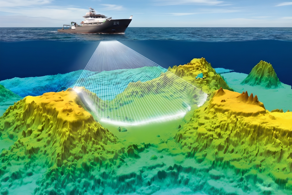
Accurately charts the topography of continental shelves, slopes, and abyssal plains.
Supports scientific research of marine geological structures, seamounts, and hydrothermal vents.
Provides foundational data for deep-sea pipeline route surveys and submarine cable laying.
Searches for targets such as shipwrecks and aircraft in vast deep-sea areas.
Provides high-precision seabed models for research on global ocean circulation, benthic habitats, and more.
| Technical Specifications |
EM 712 |
EM 304 MKII |
EM 124 |
| Operating Frequency |
40 - 100 kHz |
20 - 32 kHz (Nominal 26 kHz) | 10.5 - 13.5 kHz (Nominal 12 kHz) |
| Maximum Depth Range | 3600 m (0.25°x0.5° Configuration) | Full Ocean Depth (Better than 10990 m) | Full Ocean Depth (Better than 11000 m) |
| Typical Swath Width | Maximum 4400 m (approx. 5.5x water depth) | Maximum 14400 m (approx. 5.5x water depth) | Maximum >40 km (approx. 6x water depth) |
| Beamwidth (Example) |
0.25°x0.5°, 0.5°x1°, 1°x2°, 2°x2° etc. |
0.3°x0.5°, 0.5°x1°, 1°x2°, 4°x4° etc. |
0.5°x1°, 1°x2°, 4°x4° etc. |
| Maximum Beams per Ping |
1600(Dual-swath mode, detailed configuration) |
1600(Dual-swath mode, 0.5° and 1° RX) |
1600 (1°RX) |
| Key Features | The workhorse for medium-deep waters, balancing resolution and range, optimized for USVs. | New generation full ocean depth system, high resolution and high customizability. | Ultra-wide swath full ocean depth system, maximizing the efficiency of ocean mapping. |

Email: business@blueholeinstruments.com
Address: Gate 6, Building 29, Yuhu Nanyuan, Huanhu East Road, Jinghai District, Tianjin
© 2025-Now Tianjin Bluehole Instrument Co., LTD Copyright
Powered by:Chuangmeng Times
