Sedimentation threatens storage capacity, water intake, flood control, and turbine efficiency. Traditional surveys are slow, discontinuous, and miss dynamic changes.

Bluehole Instruments offers a fixed, long-term, automated solution using the Scanning Sonar—delivering continuous 3D terrain data at critical areas (dam fronts, intakes). Unattended operation. Real-time or scheduled monitoring. Accurate sedimentation rate, volume, and distribution.

Solution Value

  • 01

    Understand Sedimentation Patterns

    Long-term, continuous data reveals how sediment moves and settles over time, supporting informed decisions on dredging.

  • 02

    Protect Reservoir Functions

    Precise monitoring at critical points—like the dam front and intakes—helps preserve flood control capacity, usable storage, and intake safety.

  • 03

    Reduce Dredging Costs

    Targeted dredging based on accurate sediment data eliminates guesswork and significantly lowers project costs.

  • 04

    Data-Driven Management

    Builds a dynamic 3D database of the reservoir bed, supporting daily operations, safety assessments, and lifespan predictions.assessment.

Core Equipment

  • Kongsberg DAS Dual axis Scanning Sonar

    Designed for long-term monitoring

    Robust and durable, with no exposed moving parts, built for extended underwater deployment and stable operation even in high-velocity flow.
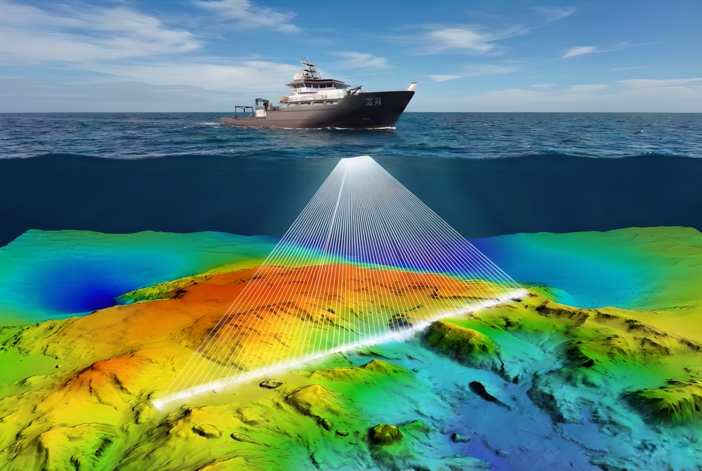
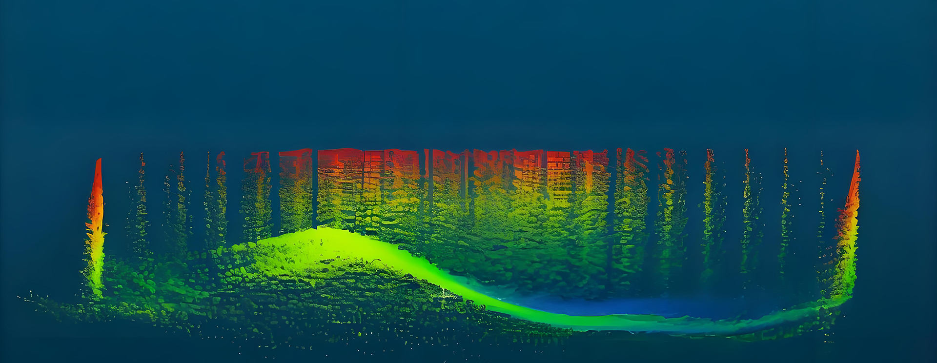
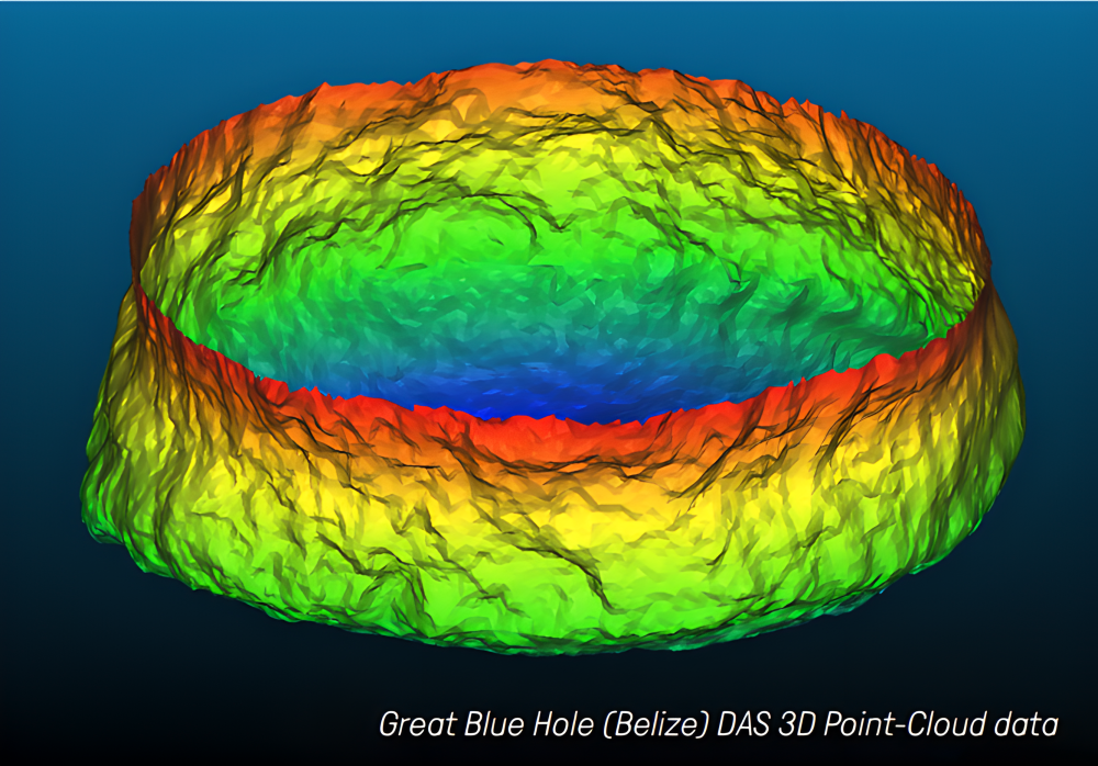
    3D Terrain Scanning

    Wide range scanning with horizontal 360 ° and vertical -90 ° to+10 °, directly outputting X, Y, Z three-dimensional point cloud data, accurately reflecting terrain changes.
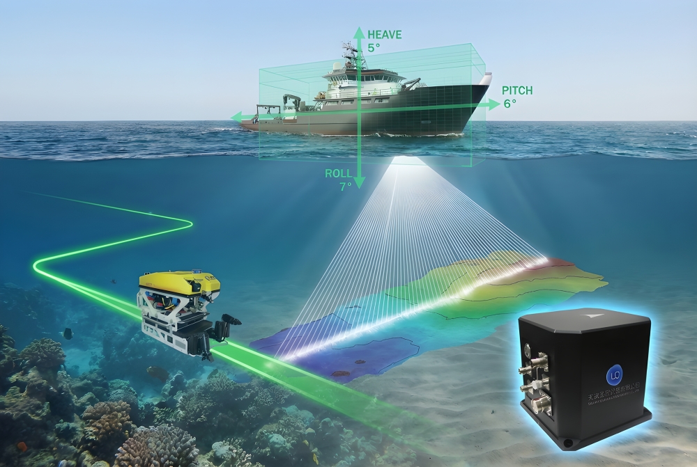
    Flexible Deployment

    Support fixed installation on dam bodies, underwater supports, or temporary deployment, and networking can achieve larger coverage.

    Low Power & Remote Transmission

    Low power consumption, supports remote data transmission back to the monitoring center through wired or wireless means, achieving unmanned operation.

  • Kongsberg EM2042 High-Frequency Multibeam Echo Sounder

    Efficient surveying in shallow water

    As a lightweight and energy-saving version of the EM2040 series, it is optimized for small unmanned boats and shallow water measurement platforms, making it easy to penetrate areas that are difficult for traditional boats to reach, such as the tail of the reservoir and tributaries, and achieving full coverage of sediment monitoring in the reservoir area.

    QuadSwath™ Technology

    Acquires four swaths simultaneously in a single pass, quadrupling data density. Ultra-high resolution clearly captures sedimentation patterns, scour gullies, and delta front evolution, providing abundant data for precise reservoir capacity calculations.

    Multi-Frequency Synchronous Sediment Classification

    Support multi frequency alternating transmission of 200-700kHz, synchronously obtain backscatter data in a single voyage, accurately distinguish different types of sediment such as silt, silt, clay, and original riverbed, construct a distribution map of sediment in the reservoir area, and provide key geological basis for the formulation of dredging and dredging plans.

    PredictivePitch™ Wave Compensation

    Built in intelligent attitude prediction algorithm actively compensates for the influence of ship motion in open water conditions of the reservoir, ensuring the continuity and high accuracy of sediment monitoring data, and completely eliminating measurement blind spots and data jumps caused by waves.

    Water Column Data Monitoring

    Records and displays full water column data, enabling real-time identification of density currents, turbid layers, and sediment transport processes. Supports reservoir sediment dynamics research and analysis of sedimentation evolution patterns.

  • Sagsea Series Fiber Optic Inertial Navigation System

    High-precision attitude and heave measurement

    The heading accuracy is ≤ 0.05 ° sec φ, the attitude accuracy is ≤ 0.01 °, and the real-time heave accuracy is 5cm or 5%, providing stable and accurate ship attitude data for the multibeam depth measurement system, ensuring high-precision 3D reconstruction of the sedimentation morphology, gully distribution, and delta front evolution at the bottom of the reservoir.

    Seamless All-Source Navigation

    Integrated GPS, Beidou PPP, RTK multi-mode positioning, supports automatic switching between satellite navigation and pure inertial navigation, and can maintain continuous high-precision positioning in areas with weak satellite signals such as canyons, reservoirs, and high dams, ensuring full coverage data integrity for sediment monitoring in shallow water areas of the reservoir tail and tributaries.

    Modular Split Deployment

    The IMU unit supports independent deployment underwater, and the deck unit integrates a GNSS receiver module, which is suitable for multi platform operations such as detection ships and unmanned boats, meeting the flexible needs of monitoring different water environments such as the main tank of the storage area, shallow waters at the tail of the storage area, and return water fluctuation areas.

    Large-Capacity Data Logging

    The built-in 32GB storage card can fully record inertial data, and after the detection is completed, it can be combined with post-processing software for tightly coupled calculation, further optimizing the accuracy of storage capacity calculation, and providing reliable data support for sedimentation assessment, dredging plan formulation, and reservoir scheduling operation.

  • Integrated Data Management & Analysis Platform

    Automated Data Processing

    The supporting software can automatically process sonar raw data, generate sedimentation thickness maps, volume change curves, and three-dimensional terrain comparison models within a specified period.

    Alerts & Report Generation

    User-defined sedimentation thresholds trigger automatic alerts; generates standardized monitoring reports for intuitive visualization of sedimentation dynamics.