Ports and waterways are global trade hubs where water depth and underwater conditions directly affect navigation safety and port efficiency. Traditional methods can't deliver the comprehensive, high-precision data modern ports demand.

Bluehole Instruments provides a multibeam-based solution for port and waterway surveying. Using advanced acoustic sensors and precision positioning, we deliver full-coverage, centimeter-accurate terrain mapping of channels, anchorages, turning basins, and quay fronts—meeting international hydrographic standards.

Solution Value

  • 01

    Ensure Absolute Navigation Safety

    Accurately detect underwater hazards such as shoals, shipwrecks, and reefs, providing reliable data for safe vessel access.

  • 02

    Support Dredging & Maintenance

    Provide precise pre-, during-, and post-dredge terrain data and volume calculations to guide cost-effective dredging and optimize maintenance costs.

  • 03

    Enhance Port Operational Efficiency

    Accurate bathymetric data enables optimized berth allocation, tide-dependent access for large vessels, and informed pilotage planning.

  • 04

    Build Digital Twin Foundation

    High-precision underwater terrain data serves as the core geospatial asset for smart port development, digital waterway management, and dynamic monitoring.

Core Equipment

  • Kongsberg EM 2040 Series High-Resolution Multibeam Echosounder

    Industry Standard, Uncompromising Accuracy

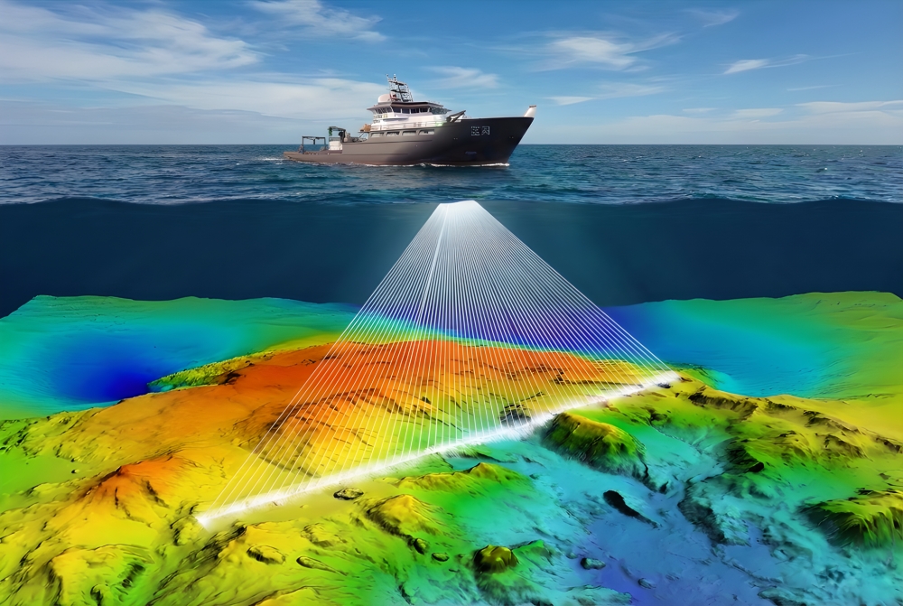
    Exceeds IHO Special Order standards across all metrics, ensuring highly reliable data point by point.

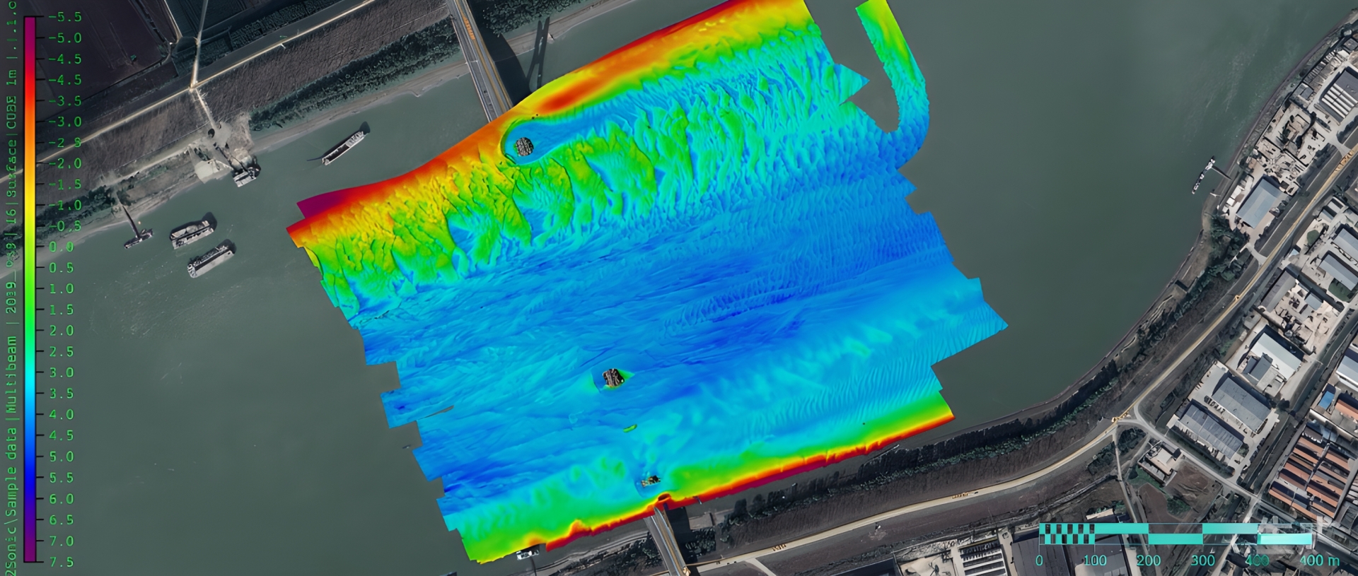
    Wide Swath, High Efficiency

    Up to 170° swath (single head) or 220° (dual head) with high ping rates for rapid corridor mapping, significantly reducing survey time.

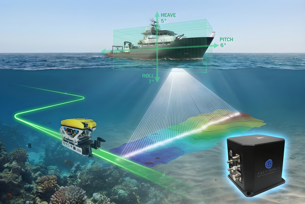
    Built for Complex Port Environments

    Advanced motion compensation (3D beam stabilization) maintains data quality even in busy shipping channels with heavy swell.

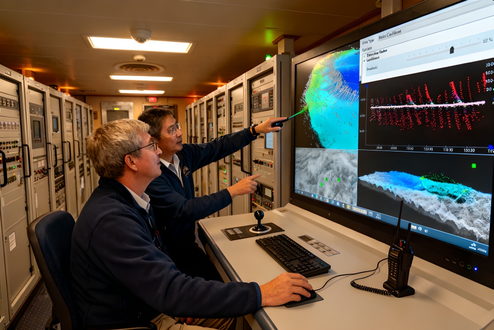
    Multi-Purpose Data Acquisition

    Simultaneously collects bathymetry, multi-frequency backscatter (for seabed classification), and water column data (for detecting mid-water hazards).

  • High-Precision Integrated Navigation & Positioning System

    Centimeter-Level Absolute Positioning

    GNSS (GPS/BeiDou) receivers with satellite-/ground-based augmentation services deliver real-time centimeter accuracy for survey vessels.

    Precision Attitude & Heading

    Integrated fiber-optic gyrocompass or inertial navigation system (INS) provides accurate roll, pitch, heave, and heading data—critical for multibeam data quality.

    Seamless Integration

    Navigation and positioning data synchronizes in real-time with multibeam acoustics, ensuring a unified and precise coordinate framework.

  • Full Process Data Processing & Result Delivery

    Automated, Standardized Workflows

    We use international mainstream software such as QPS Qimera and CARIS HIPS to perform tidal level correction, sound velocity correction, data filtering, and stitching into maps, with standardized and efficient processes.

    Comprehensive Outputs

    Deliver digital depth models (DDM), contour maps, 3D seabed terrain models, depth point files, and specialized reports that comply with international standards.