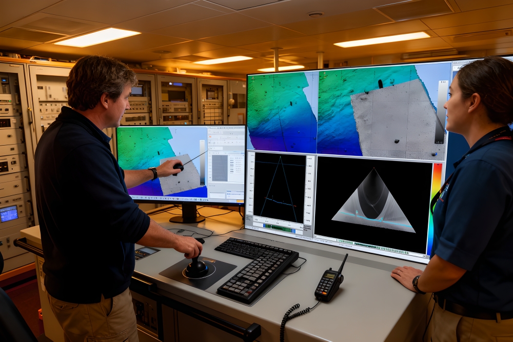
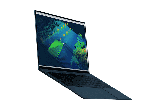
QPS Qinsy 9 Measurement Data Collection and Navigation Software
Home/Products/Global Partners/Software/Navigation Software/QPS Qinsy 9 Measurement Data Collection and Navigation Software

QPS Qinsy 9 Measurement Data Collection and Navigation Software

Simplify complexity, precise and efficient

QPS Qinsy 9 is a comprehensive marine surveying and navigation software platform focused on measurement planning, data acquisition, and real-time quality control. The system has its core advantage of recognized excellent stability in the industry, ensuring smooth and efficient operation of measurement tasks. Qinsy 9 supports a variety of application scenarios, from simple single beam measurements to complex offshore construction operations, and is fully compatible with all mainstream hardware manufacturer devices, providing unparalleled reliability and flexibility.

QPS Qinsy 9 Measurement Data Collection and Navigation Software

Key Features & Advantages

Main Applications

  • Marine surveying and hydrological investigation

    On site data collection and real-time quality control for tasks such as channel measurement and seabed topography mapping.

  • Offshore engineering construction and construction

    Provide precise navigation positioning and real-time construction monitoring for offshore wind power installation, subsea pipeline laying, platform construction, etc.

  • Dredging and Channel Maintenance

    Specially designed for dredging operations such as rake suction and cutter suction dredgers, providing job configuration, real-time monitoring, and visualization functions.

  • Scientific investigation and resource exploration

    Support multi-sensor collaborative data collection and on-site quality monitoring in scientific expeditions such as marine geology and geophysics.

  • Autonomous and unmanned ship measurement

    Provide mission planning, real-time control, and data acquisition monitoring support for autonomous vehicles such as AUVs and ASVs.

Specifications


Technical indicator  Specification
Core functionality
Support sensor types Single beam, multi beam, LiDAR, side scan sonar, magnetometer, seismic survey, shallow subsurface profiling instrument
Positioning and Input GPS、INS、 Tide level USBL、 Multiple input sources such as draft, supporting Kalman filtering
Real time display function Navigation display (supporting ENC, DXF/DWG, GeoTIFF and other layers), multibeam display, numerical display, profile display, 3D display
License Options
Qinsy 9 Offshore Edition Supports unlimited systems and objects, suitable for any offshore application, including multi-sensor, multi object, water column recording, backscatter recording, etc
Qinsy 9 Offshore Construction Edition Specially designed for dredging operations, no system redundancy required
Qinsy 9 Single Beam Edition Suitable for small single beam or single beam side scan sonar operations
Optional Additional Modules Side scan sonar, dredging, shallow subsurface profiling, cable laying OPC、 Remote display client, etc
Authorization and Support
License mode Subscription system, perpetual license or lease
Activation method Soft lock or hardware dog