
Modern and intuitive interface
A brand new user interface design simplifies the project and measurement vessel configuration process, supports quick initiation of ocean measurement tasks, and reduces operational barriers.
CARIS Collect is a modern ocean measurement data collection software that simplifies the creation and management process of ocean measurement projects through an intuitive user interface. This software is designed specifically for ocean survey workflows and can be quickly integrated into various measurement operations, allowing even new operators to quickly get started.
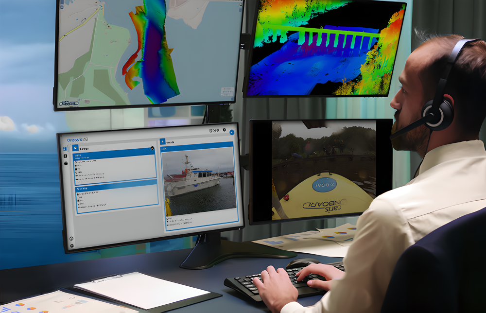
As a key component of the complete CARIS "from detection to mapping" solution, CARIS Collect provides a full process tool from data collection and processing to data management and result distribution. When used in conjunction with CARIS Onboard, the collected data can be automatically imported and processed during the measurement process, achieving near real-time remote quality monitoring and ensuring the quality and efficiency of measurement operations.
A brand new user interface design simplifies the project and measurement vessel configuration process, supports quick initiation of ocean measurement tasks, and reduces operational barriers.
Support the collection of various sensor data, including multi beam sonar, side scan sonar, single beam sonar, shipborne laser scanner, navigation, and sound speed profiler.
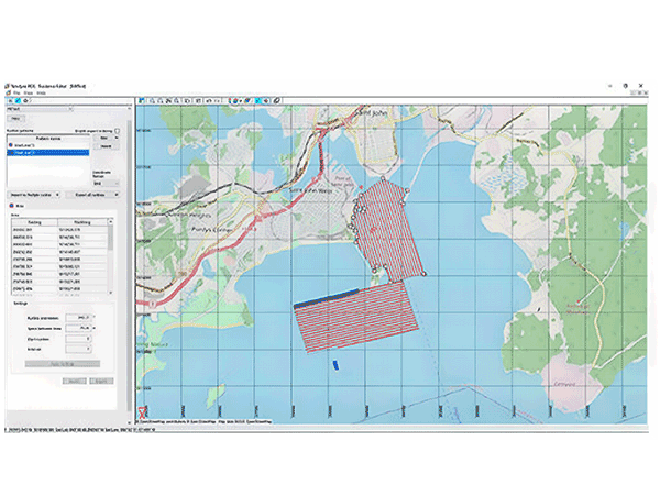
Provide professional measurement planning tools that can create and load preset survey lines, and use them in maps and helmsman views, supporting planned survey lines and free-form measurements.
Real time data stream displaying raw data and geographic references online, supporting 2D/3D and waterfall display, real-time monitoring of measurement progress and data quality.
Apply real-time corrections such as filters, sound velocity correction, and water level adjustment during data collection to ensure data quality.
Provide seamless data flow with the "from detection to mapping" workflow of CARIS, including all raw data, auxiliary files, ship parameters, and calculation results.
Used for on-site data collection in projects such as underwater pipeline inspection, channel dredging, and offshore wind farm construction.
Provide high-quality and standardized source data collection for the production of electronic navigation charts.
Support multi-sensor synchronous data collection in marine scientific research to meet the needs of comprehensive marine surveys.
Combining with CARIS Onboard, achieve near real-time quality control and remote progress monitoring of measurement sites.
It can be integrated with autonomous platforms such as AUV and ASV to achieve data collection and management for unmanned measurement operations.
| Technical indicators | Specification |
| processor | Latest generation multi-core CPU (minimum 8 threads) |
| Graphics card | NVidia ® Or AMD ® Display adapter, compatible with OpenGL 3.3 GPU, 4GB video memory or NVidia GeForce GTX 1080/NVidia Quadro P1000 or better |
| Memory |
16 GB RAM |
| Network | Gigabit Ethernet |
| Storage | 7200 RPM hard drive or solid-state drive, with at least 2.5 GB of available installation space |
| Operating system | Windows ® 10 Professional 64 bit or Windows 11 ® 64 bit |

Email: business@blueholeinstruments.com
Address: Gate 6, Building 29, Yuhu Nanyuan, Huanhu East Road, Jinghai District, Tianjin
© 2025-Now Tianjin Bluehole Instrument Co., LTD Copyright
Powered by:Chuangmeng Times
