| Technical indicators/modules |
Bathymetry
|
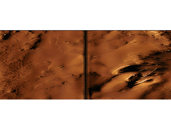
Sidescan
|
Sub-Bottom
|
Magnetometry
|
| Product positioning |
Multi beam water depth processing and terrain modeling |
Side scan sonar data processing and target management |
Shallow stratigraphic profile interpretation and stratigraphic modeling |
Magnetic data acquisition and anomaly analysis |
| Core functionality |
| data collection |
Real time multibeam data acquisition |
Real time side scan, navigation, and synchronized water level collection |
Real time shallow subsurface, navigation, and magnetic synchronous acquisition |
Real time magnetic, navigation, and sonar synchronous acquisition |
| Processing tools |
Calibration, editing QA/QC、 Six grid algorithms |
Navigation correction, gain control, signal filtering |
Navigation editing, tide level correction, shake removal |
Navigation correction, filtering, smoothing, data restoration |
| Interpretation and Visualization |
3D editing, backscatter analysis, volume calculation |
Target management, substrate classification, and mosaic image generation |
Intelligent geological tracking, 3D grid map, and equal thickness map |
Abnormal automatic recognition, 3D surface, color bar chart |
| Device compatibility |
| Mainly supporting brands |
EdgeTech, R2Sonic, Klein, NORBIT
|
EdgeTech, Klein, Marine Sonic, Tritech
|
EdgeTech, Innomar, Klein, Knudsen
|
GEM, Geometrics, Marine Magnetics
|
| Data output |
| Export format |
XYZ, DXF, SHP, KML, GeoTIFF and other 20+formats |
XTF, Geographic reference images, GIS, CAD |
SEGY, XTF, GIS, CAD
|
Geographic reference images, GIS, Office reports |
| result map |
Isobaths, differential analysis map, 3D terrain |
Side scan mosaic, target catalog, substrate classification map |
Stratigraphic section map, isopach map, 3D grid map |
Magnetic contour map, anomaly distribution map, 3D surface |
| system requirements |
64 bit Win, DirectX11+, 8GB RAM, SSD |
64 bit Win, DirectX11+, 8GB RAM, SSD |
64 bit Win, DirectX11+, 8GB RAM, SSD |
64 bit Win, DirectX11+, 8GB RAM, SSD |
| Core Features |
Multi algorithm terrain generation and change detection |
Large scale target management and intelligent query |
Intelligent stratigraphic tracking and volume calculation |
Automatic anomaly recognition and multi data integration |